The contest is almost at an end and that means that the time to make points is dwindling. At this stage, points amount to being a certain amount of time ahead or behind another. And today, Noah had his work cut out for him. He was in second place, a little over 60 points behind Mike Sorenson.
My landout on the thunderstorm day ended any hope of me having a reasonable performance here. Going into the last two days, all I’m concerned with is helping Noah get to the top of the podium. To do that, Noah needed to have a clean flight, but make a clean break from Mike. A tie would not serve Noah well going into the last day. We strategized having either an early or late start, whatever it took for him to break out on his own.
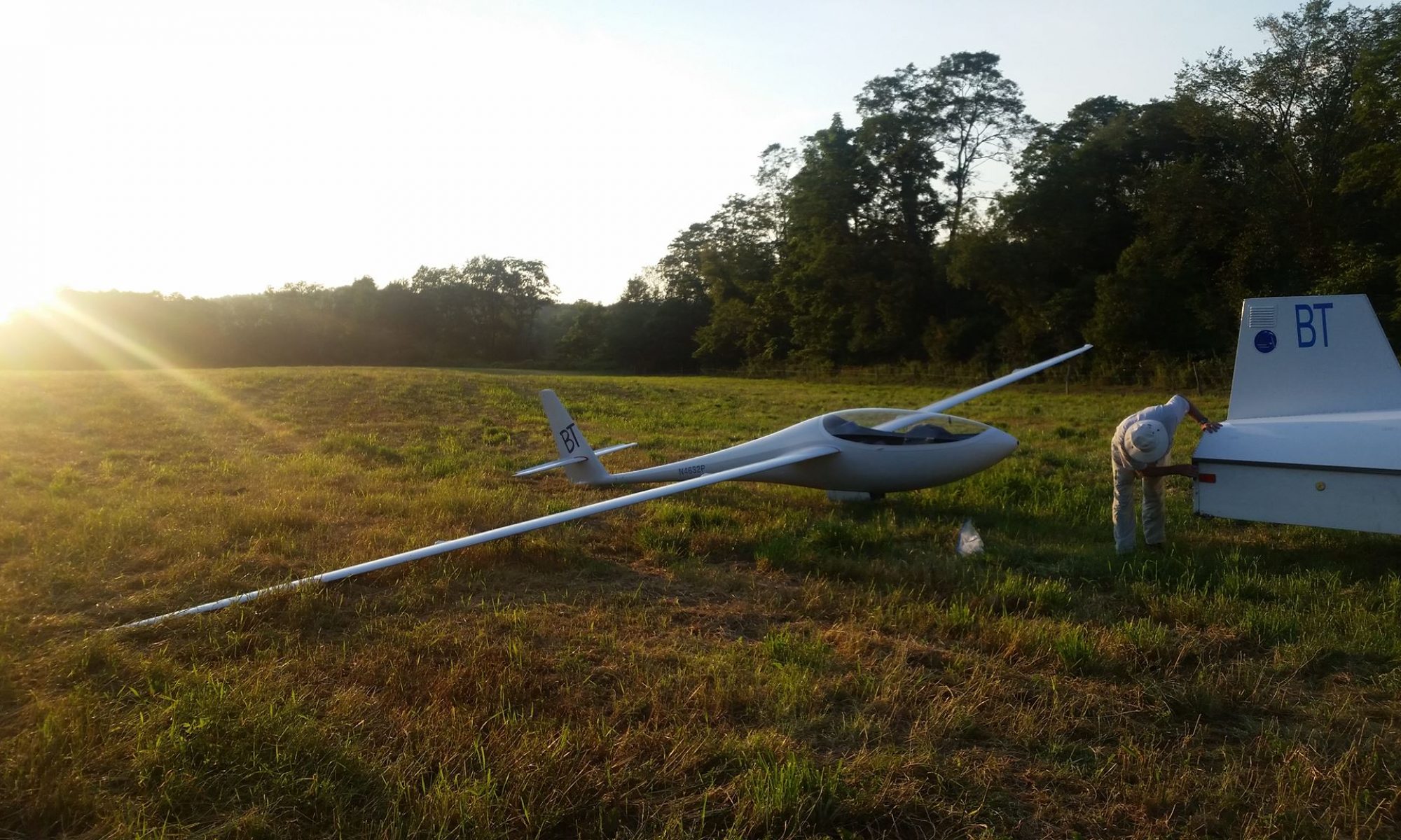
My morning went to pieces. I had trouble the glider and spent all morning getting it ready. It was a bit of a rush to get set up on the grid and be contest ready. I reviewed the assigned task, a nice 217 mile sprint, and the weather on my phone. John Bird also gave us some forecasting advice. The day should peak late, with cloud suck and vertical development. Watch out for the cirrus at the end of the day.
We launched and Noah and I got together. The day was taking a while to cook, likely due to some residual ground moisture from the storms several days ago. Starting early was not the best strategy. We waited under a cloud, and Mike joined us. What to do?
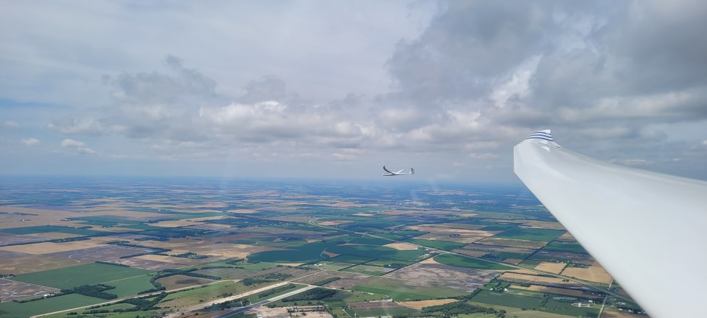
We waited and waited. All of the Club Class and 15 meter glider had gone. The 18 meter task was just about to open. At 2:30pm we headed out to the line. As I turned the line, I saw Mike glimmer two minutes behind us. I smiled, went for the line and then made a hard right back to the cloud that we came from. We created a dilemma for Mike; start now with the prospect of catching some folks ahead, or give chase to us and potentially be dropped behind the pack at the end of the day. Covering several minutes behind is tricky; maybe that cloud several miles from the start won’t cycle in below if he gives chase. In the end, he took the bait and rolled out on task.
Noah and I peddled hard to get back to the cloud and climbed up. 10 minutes later, we went through the line again, now with the 18 meter gliders just ahead on our left and below. We pressed hard, climbing only in the best lift. We made good time on the downwind leg and drove into a busy thermal close to the first turn. We caught Mike!
At this point, I started to fade. The heat and the morning excitement was getting to me and my performance was dropping off. Noah was now 600ft above, in perfect position with the gaggle. I felt like a spent bicycle racer, having gotten my lead man to where he needed to be. He made his break and I contented myself to simply get around.
The second leg worked out fine. I took the less travelled line to the left and it did not work as well. I got low approaching the high cirrus rolling in, though I connected, got in and out of the turn and set up for final glide. I got home 15 minute after Noah, about middle of the pack. Noah’s glider was already parked and mostly put away by the time I opened the canopy.
First thing I asked Noah was, “Did you beat Mike home?”
Noah grinned ear to ear and reported that he beat him home by 30 seconds. He got him by a full 10 minutes and was now only three points out of the lead.
It’s been a wonderful August. Having returned from some exceptional soaring out west while on my honeymoon, I was not expecting much from Blairstown. This time of the year tends to yield hot, hazy, and humid conditions. The kind where you can hardly see more than several miles away at several thousand feet. When you spend all day circling while the variometer occasionally beeps to remind you it is still on. When you yawn and start falling asleep as you keep going round and round in a thermal, to get high enough to make a several minute glide, to repeat the process all over again. Should you venture away from the airport, it is the frequent excitement of looking for airports and fields to land in that keeps you awake.
Not this August. Upon my arrival, I learned that the northeast has been enduring the longest sustained drought in two decades. The poor farmers… and the grinning glider pilots! Cool nights followed by hot and dry days set up long soaring days with high thermals, at times exceeding 9000ft. It was like the club awoke from a long slumber and pilots starting flying every chance they could. Make hay when the sun shines, at least if you’re a soaring pilot!
I had the most productive thermal soaring stretch I’ve ever experienced around here. Four flights, all exceeding 300 miles in distance achieved and averaging over five hours apiece. On the first I completed an out and return to Harris Hill, traversing the tricky high ground over the Poconos to transition toward the beautiful clouds beyond Scranton. One of the notable features of that flight was that the conditions were fairly heterogenous; there were pockets of good thermal activity and large stretches of blue in between. And by blue, I mean the totally dead and smooth kind of blue. I convinced myself that with a 50-1 ship that it should get across those challenging spots without too much difficulty, which worked out as intended.
Crossing the Poconos toward the clouds off yonderMade it to Harris Hill!Heading back across the lake-effected blue hole.Excellent conditions over the Alleghany plateau!Long, dead glide over the ridge from Hawk Mountain to the last working clouds at 6:45pm near Cherry Valley.
In the following two flights, I worked the thermals forming along the northwest and southeast sides of the ridges for my first leg, followed by running east toward the coast and then back home for a long flight with a 300-400km triangle embedded within. The most exciting portions of these flights was flying in the vicinity of Philadelphia and Trenton, areas that typically are weak, wet, and dicey. Instead, I found some of the strongest and highest thermals in these areas, offering the ability to explore farther into New Jersey than I’d ever flown before. Maybe I could even venture to the Jersey shore? However, on both flights I ran into weakening conditions near Old Bridge as I crossed through the sea breeze front.
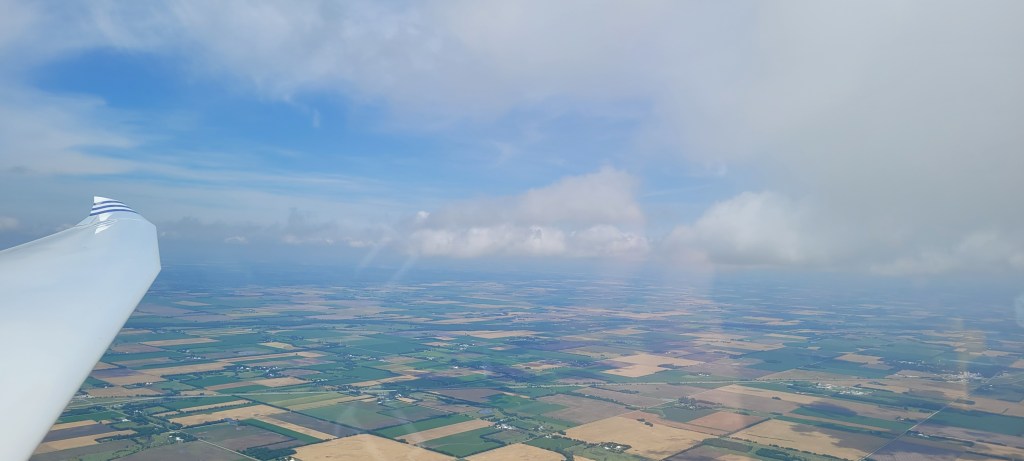
Storms developing along a trough early in the day.
On the first instance, I barely escaped back to Princeton where I finally connected with lift that allowed me to complete a long and dead final glide under light drizzle. On the second, the sea breeze was pushed far inland due to the southerly winds. I found the step and a good single thermal, though it was not positioned satisfactorily relative to the surrounding airspace to take advantage of it as a lift line.
Looking toward Monmouth County and the spread-out conditions late in the day.Heading toward Trenton on a southerly wind. Notice the dip in the clouds on the left. That is the sea breeze front!
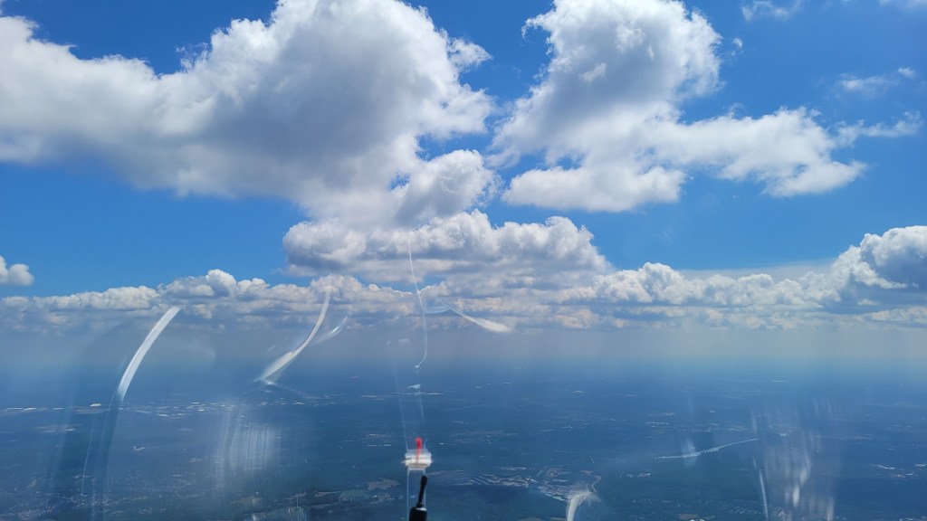
I had been fascinated by sea breeze fronts for a long time. I have seen them many times driving along the Jersey shore. It is defined by a line of blue, marine air paralleling the ocean, with a well defined line of cumulus clouds where the marine and warm and dry continental air collide. The clouds form a step, with the lower step forming a drooping curtain that looks like a waterfall. From the air, it looks like you are approaching the end of the four corners of the earth.
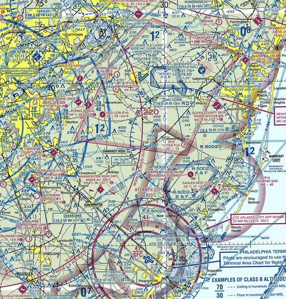
I’ve always wanted to experience flying along the front. It would be a lot of fun to soar along the long, defined edge. But there are several significant challenges that often preclude taking advantage of it. For one, the Jersey shore is a solid 50 miles away from Blairstown in the low and wet ground. This August is an exception to that rule and instead one could expect good soaring conditions in those areas. Secondly, the airspace is quite busy with extensive GA traffic. Thankfully Bill Thar installed a transponder in the Duckhawk, so this aspect was manageable. Thirdly and most importantly, the Jersey shore has complicated airspace. Bordered by the NY Class Bravo to the north and the McGuire MOA, several restricted zones, and the Atlantic City Charlie to the south, soaring the sea breeze would be no picnic. Further, the positioning of the front can move inland later in the day, which could create a situation where a pilot could head south early and then either run into airspace or fall out into the bad, marine side on the trip back north. These challenges had precluded my previous attempts to soar the breeze.
The airspace is so complicated here, it felt like I was taking a flight test all over again looking up the regs to see what I could and could not do.
August 25th was when all the pieces finally came together. On this day, I just broke way from Blairstown and headed south first thing when I got up, regardless of the conditions setting up later. I took off at noon, settled into a thermal under the first cumulus cloud of the day along the ridge. Once at cloudbase, I could see the first clouds forming to the southeast near Hackettstown. I slowly floated out, taking every thermal, easing into the day. I had never left this early toward this direction before. It was exhilarating breaking from the standard mold of what we normally do and felt like I was flying at a completely different site!
Clouds finally firming up near Solberg Airport, heading toward the sea.
My first solid thermal was near Round Valley reservoir and now I was established comfortably at 5,500ft. Nice looking cumulus clouds formed ahead and I picked up the pace. In what felt like no time at all, I was approaching Monmouth county and I saw the tell-tale signs of the sea breeze beckoning ahead.
Near Monmouth County. The clouds end not so far ahead!
Initially I downshifted and tried to get connected back to cloudbase again, though I was unable to find a solid climb. Initially, I followed the clouds all the way to the edge, right under the step. This did not work and I had to zig-zag back to the northwest when I finally connected with a solid thermal. What happened was I failed to recognize that the shape of the front created a wedge, with the apex of the wedge just under cloudbase and the marine air creeping in underneath. As I climbed, I drifted along the wedge up to the clouds, where I finally found consistent lift along the line.
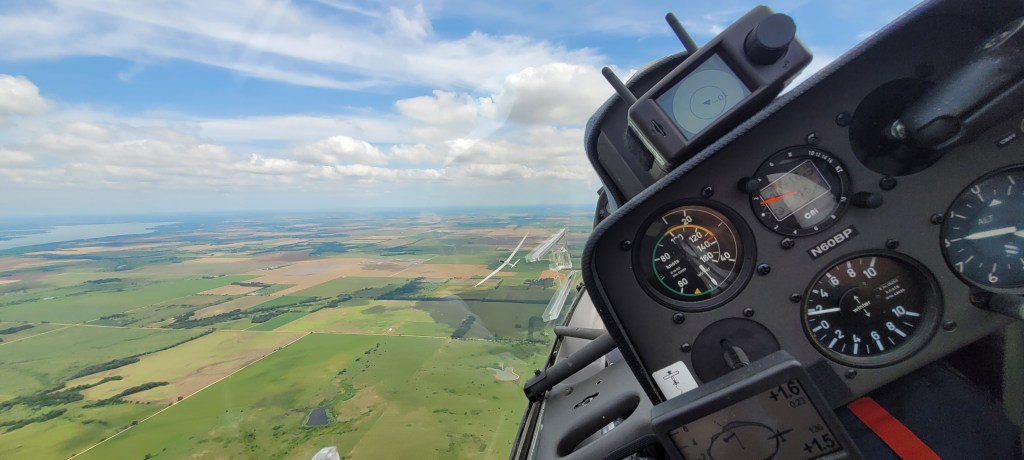
As I headed south, I saw a flight of six fighter jets flying underneath in formation. Looking ahead, I was close to Lakehurst air force base and soon to enter the MOA. I tuned my radio to McGuire Approach, figuring that it was prudent and courteous to communicate with them. The radio was very active and I could hardly get a word in edgewise. When I announced McGuire Approach, Glider Four Six Three Two Papa, they got back to me and gave me a squawk code for my transponder. The controller asked me where I was heading and my intended altitude. I responded that I was heading toward Coyle Airport, an airport right on the edge of the following restricted zone and would fly between 5,500-6,500ft.
It was pretty nerve-wracking soaring the line. A little to the left and there was dead air. Off my right, there was restricted airspace. Ahead the airports were well in glide, though about ten miles apart. There was little room for error for if I started to drop it wouldn’t be easy to reconnect with the line. Finally I wanted to fly a bit more predictably for the benefit of the controllers; zig-zagging around like a crazed rabbit would cause me to be a burden and distraction to them. So I focused on the lift ahead, listened to the radio, and watched as C-130s took off underneath me.
The sea breeze is apparent here. The best lift is just to the right of the hanging curtains, under the flat cloud.The shore and ocean are only ten miles away.
The lift was mostly consistent, though not strong. I floated along at 60 knots, bumping along here and there. The best section was about 20 miles into the run, with a solid 6 knot thermal to 6,700ft along a solid wall of cloud. Ahead the breeze extended into restricted airspace and there was no obvious path on the continental side to extend around the back. So at Coyle Airport, 30 miles from where I started, I turned around and heading back north.
Best part of the sea breeze was here. Solid and consistent lift was found under these clouds.Looking farther to the south, the conditions deteriorate. With a restricted zone ahead, I turned around here.
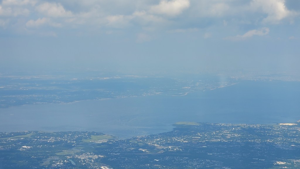
Coming back north was less stressful as I quickly attained comfortable glide back to terra firma in the form of Princeton Airport. I knew that even if I lost the line that I would make it back to soarable territory. The line lost some definition near Monmouth County, though persisted for 40 miles all the way to the New York Class Bravo. I flew right to the edge of the airspace, peering out into the haze in the distance. I could make out the skyscrapers, the Verrazano Bridge, and the whole profile of Staten Island. I had never seen the “Vee-Zee” as us New Yorkers call it from the Harbor side in a glider! I thought to myself that I could glide to my parents’ house from there.
Heading north bound. Lakehurst AAF is visible on the left. The lift can be seen on the right.The lift line is less defined. The NY bay is visible in the distance, along with Staten Island.New York City is shrouded in haze. The Verrazano towers on the right side.
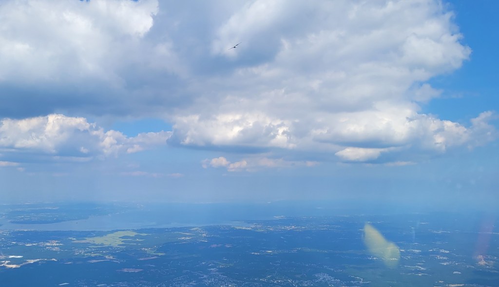
Near Old Bridge Airport, I saw a speck at my altitude. Turned out it was an eagle, and I gladly turned into his thermal. As I went round and round, I saw the profile of the bird outlined against the whole city. Later I looked down and saw that he was flying with a friend! This pair of eagles climbed right through me. The brief thought to give them chase was dashed when I saw the eagles head straight toward Newark, into the Class Bravo airspace. Then I remembered that is what happens when you try to fly with creatures that are motorgliders and are exempt from ADS-B Out, Mode S transponders, altitude encoding altimeters, and even talking to the controllers! We parted ways and I headed west toward nice looking cumulus clouds near the Delaware river.
Bald Eagle soaring and New York City in the distance.
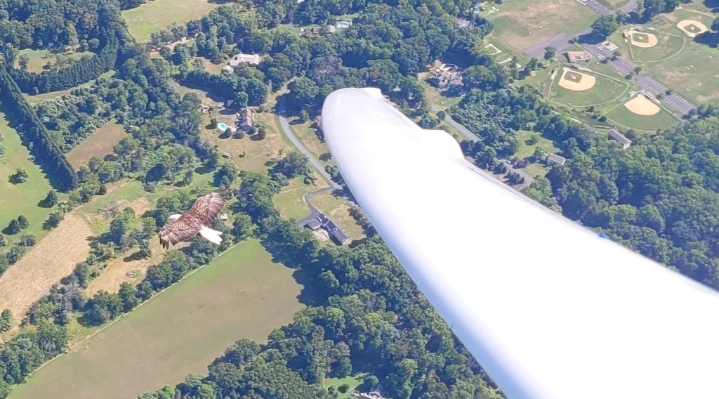
After a long glide, I got low enough to get a little grumpy and had to pay attention to landing options in the form of Van Sant airport and Doylestown as my outs. But as I crossed the river a little over 2000ft above, I saw yet another pair of eagles! I connected with a solid three knot thermal and rode up with these beautiful birds. I had several circles where one of the birds got very comfortable getting close to the Duckhawk, perhaps within several feet from my wingtip. It was surreal!
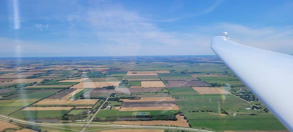
After the long climb, I looked over and saw that the high cloud cover off my shoulder to the left was arriving slower than expected. Ahead the clouds were high and well formed. This suggested that the day should last longer than forecast, so I kept heading west to extend my distance. After crossing the typical Kutztown hole, it seemed like the clouds were on steroids. A six knot thermal north of Hawk Mountain took me to 7,500ft. It looked like with the light winds there was some ridge-based convergence setting up in the area, creating bonkers lift. I ran the line just shy of Schuylkill County and headed along the edge of the ridges back toward Blairstown. The air felt marvelous!
Heading northeast along Sharp Mountain. Excellent pockets of convergence formed in the light winds.
Along the way, I enjoyed thermalling the Duckhawk. I finally felt like I had figured out how to thermal it. After extensive work to get the center of gravity in proper balance and seal ingthe canopy, I can thermal it shy of 50 knots in a solid 40-45 degree bank and 45 knots in a 35 degree bank and more flaps. Thermalling it is tricky because it gains energy so easily. You have to pull right on every gust and back it off just so when you fall off on the back side. After flying it for several hundred hours, I realized that I was doing this effortlessly and I was finally dialed into the glider.
Last, two knot thermal of the day near Walpack, NJ.Final Glide over the ridge back to Blairstown.
After returning near to Blairstown, I climbed up to cloudbase and rode the last remaining bits of lift toward Dingman’s Ferry, completed my final glide in dead air and landed past 6 pm. I was very pleased to have notched another flight off my soaring bucket list; the New Jersey sea breeze has been conquered from Blairstown. This flight also doubled as my longest distance flown solely on thermals from my home site with 577km achieved on a six hour flight. Not bad during the so-called doldrums of August!
Only two days left in the competition and we’re second overall. There are not many opportunities left to make a play for the leading position and today looked like the best opportunity. The weather looked good, with high thermals promising a long soaring day and a long soaring task. This would lead to more points awarded for the day, and also possibly greater point spreads among the competition. The weather was most complicated by the presence of a cold front stalling in our area. This front was dry enough that it would create strong lift at its boundary and the task was designed for us to run along it toward Oklahoma.
Noah and I looked at each other and understood that the long game was over. No longer are we holding back, playing for consistency and maximizing the expected value of points over time. Today was the day to push and go for the win.
I was anxious. Timing was everything. We watched the front, trying to pinpoint when it would pass and how it would set up within the two turn sectors to the south and west of the airport respectively. Would it pass early, requiring an early start and a deep push south? Would it pass late, require a later start and stay to the north? How would the other contestants play the conditions? Should we be on the front end or the back end of the start? How are the conditions going to be on the front end or the back end of the front? On the front side, there will be a strong southerly headwind, but stronger thermals. On the back end, perhaps lower and bluer, but less wind. But then there’s the headwind at the end of the day and stronger sink along the way. So if the front moves faster, then we may have a lot of trouble getting back. But perhaps we can hook around the back of it, accepting a deviation over the lake? Besides, how is the front going to set up anyway? Theory suggests it looks like a wedge, but how will the clouds look? Will there be a step? How will we find it? What are the clouds doing upwind of us right now? Is that hazy layer northwest of us the front??
My thoughts kept going round and round in my head, with little resolution or recourse. Noah was somewhat bemused, watching as my eyes flitted about in an agitated state, trying to make sense of my stream of consciousness. He was right there with me, looking at the forecasts, and sort of resigned himself that we will just need to figure it out when we get up there. Having accumulated all the information I could, I accepted the range of uncertainty in the day, and we finally sketched out a couple scenarios for how we could play it. In all cases, we needed to drive hard and roll on our own. If we played the same flight as the others, today it would not do.
With an early grid, we got in the glider a little after noon, looking at a fairly stiff quartering headwind for takeoff and good looking cumulus clouds just above us. We released in good air all around, suggesting that the front had finally arrived. We climbed up, got in position with the other gliders and waited for the gun to go off to indicate the start was open.
We watched the Standards go quickly and figured that the 20m folks would do the same. Sure enough, just before 1pm, our class streamed out on course. We held our breath for a couple more minutes and took a more easterly route. This got us a little higher on the start and a straighter run under better looking clouds.
We stepped on the gas. It was like I had a little prod and I would poke Noah every couple minutes and repeat, 85-90 knots!
We were catching up to several Standards on the first leg, and were looking at many southwesterly streets lined up with the wind. We couldn’t quite figure out where the front was, or where the best place to go. We drove short of the middle of the first sector, and the clouds further to the south looked lower and less defined. We figured that this was a good place to turn and set up for the following leg.
Noah was flying exceptionally well, right on the ball. We were loaded up with water ballast for extra weight to go faster, but he was cleaving this 70ft wide bird into the turns with little effort at all. The glider flew poetically, smooth, and gracefully. I always enjoyed watching him center the thermals; with a turn and a half the variometer was always humming a cheerful three to four knots around the turn.
I would keep an eye on course and watch for other gliders. As we would climb up, I would give a gentle nudge by suggesting maybe we could do better, and Ready. Despite being in the same glider, we still ended up using a fair amount of the standard team-flying lexicon for consistency.
Noah would reply, Ready… Last turn!
And off we would go.
On the second leg, most of the decisions were collaborative. Left or Right?, we would ask each other. There were good thermals out there, but the lift band seemed to work best higher under the clouds. It seemed like every two or three minutes there was a big tactical decision to make in terms of where to go under the clouds, like tiptoeing over a minefield. We mostly managed to stay connected with the lift.
Crossing into Oklahoma, the thermals started to get somewhat farther apart and the clouds lost some of their definition. With a 20 knot headwind, we still had to keep the pressure on, though we started to get lower and into the trap. We finally found a 2.5 knot thermal at 3800ft and promptly parked there to reconnect with the higher lift. But then Phil Gaisford in Standard Class started turning about a half mile off of our right wing, going up like a banshee. We joined him and found a solid 5-6 knots! Thanks Phil! Ryszard and David Hart also joined us and we ended up in the same area for a fair amount of the remainder of the flight,
It was a big decision how far to go into the second sector. On the one hand, once we turn we would now have the tailwind and streeting on the way home, which would suggest that we would go a lot faster than when we were flailing ourselves against the 20 knot headwind. On the other hand, the front was likely to keep pushing southeast, further away from the airport. If we went too far and if we fell off the day, we would have to then struggle into even weaker and blue conditions late in the day. A couple minutes here or there could determine the contest, 170km away from home.
I pushed Noah to extend a little bit farther. There was another cloud ahead and we milked the good air on the upwind line. We ended up turning with ten minutes extra on the clock and then turned tail for the mighty race back to the finish.
We now found ourselves getting lower and lower. We really did not want to fall out of the band and were willing to take a long, slow climb. Besides, with the tailwind, a 2.5 knot thermal ain’t so bad anyway. But we struggled to connect, having difficulty finding the thermals under the broad cumulus clouds. As we ground our way up, the thermals seemed to get cut off at various altitudes, making it a struggle to get all the way up. But with every climb, we ended up higher than we started. And about halfway into the leg, we were up at cloudbase, making great time with the tailwind, good air under the clouds, and high true airspeed. We were making such good time that we were likely to come in under time at this rate.Might as well stay conservative now and stay connected with the good lift.
Coming close to home, we were worried about the final glide. We wanted to tank up and then some to account for the change in airmass. We got ourselves on a MC 3 glide, but we knew we needed extra. The thermals started tapering off and we down-shifted. But we did so a bit too late. We were now on the back end of the front and the variometer dropped. We were bleeding altitude and we could see the airport rising in front of us.
Looking down at the windmills, one side had the wind blowing from the northwest, the other side from the south, and down the middle it was southwest. We were right over the convergence zone, but not in the good air.
I could feel the rudder pedals dancing back and forth. Then I heard from the front,
“Noah is not happy.”
I was anxious too, but it’s an odd feeling being in the back, watching your contest completely unravel in front of you as you rapidly hurdle toward a field short of the finish. It’s almost comical watching the scene as a fly on the wall, having felt it on my own account so many times before. I snapped out of it, cleared my throat, and tried to take a level tone.
“The air looks blue and hazy, but it shouldn’t be dead yet. Keep steady, we should find one out here.”
Down at 3800ft, I saw a vulture.
“Bird! 2 o clock!”
Noah responds,
“Where!? Oh, good visual!
He hauls the glider to the right. Good air, but no thermal quite yet. Five Mississippi, and sure enough we roll into a 2.5 knot thermal in the blue.
I interject,
“Dump the water?”
And Noah responds with Roger and opened the valve.
We climbed up, took in some extra altitude and sailed on home. Looking down, we could see that our main threats were still not there. We knew we had a good day.
When we landed, we were exhausted. Unlike the second day with its adrenaline rush finish, we sort of hobbled out of the glider, zonked from baking in the sun and being under the pressure knowing that we were walking a tightrope the whole time. We were satisfied we got through and were happy that the several times we rolled the dice today that it went in our favor. This has set us up about 200 points over second place going into the last day of the competition, which is about as good of a place as we can hope for. Here’s to hoping we don’t squander it.
________________________
We thank the Harris Hill club for supporting us at this contest by letting us use their Duo Discus. This glider is an absolute marvel of performance and it has made it possible for us to compete at the highest level among the best pilots in the United States. We really appreciate all the work it takes for clubs to make these opportunities happen.
I was rudely awaken to a loud clanking at 3am. The vent above my head was fluttering and chattering in what sounded like hurricane-force winds around me. After tightening the latch, I easily went back to sleep, though others on the airfield were not so lucky. Piet Barber’s tent got obliterated by the gust front, with the sidewall of his tent smacking him across the face to wake him up. I pictured the scene like from a horror movie, with some shape shifting invisible demon going in and trying to suffocate you with tent padding in the middle of the night. With the rain pouring down on the field, he soon abandoned his valiant efforts to weather the storm in his humble abode. Quack Quack was seen run-skipping through the puddles to safer quarters in the clubhouse for the remainder of the night.
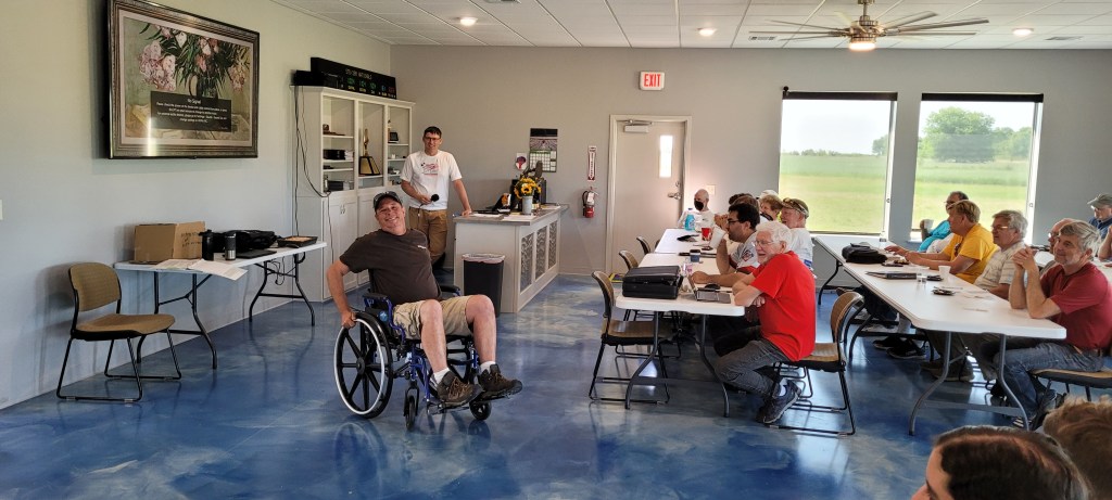
The airport received about an inch of rain, though the morning looked more optimistic than after our past rainy nights. The sun was shining, the wind was blowing, and it looked like the puddles were evaporating. Our task for the day was a three hour turn area task, which looked reasonably doable. We also celebrated Mitch’s birthday, bringing out the wheelchair to address his mobility limitations with advancing age.
After the meeting, Noah, David McMaster, and I retreated to the camper van for our morning huddle session. Sitting around the task, we saw several complicating factors. The first was that the soundings indicated high cloud cover should shadow the ground, preventing the essential sun from heating the earth and providing us our necessary thermals. The second was the presence of converging wind-flows just to the south of our location, which could provide a lift line of its own account. Finally, with all the rain in the local area, it should be tough going to get up and away, though further on course it was considerably drier and should provided better thermals. Content with our respective plans, we discussed general tactics and strategy, with an eye for practicing for the upcoming junior worlds. David has been very receptive to coaching and has been doing a great job in this contest!
Now that the gliders were all parked on the grid, it was time to wait for the ground to cook and the sniffers to launch and let us know how the thermals were setting up. Noah and I retreated to the clubhouse, where of course Alex Westbrook was milling about. He challenged me to a foosball match, and by golly the rascal beat me! He has been practicing, that’s for sure!
After playing several matches, he went over and picked up some of Mitch’s birthday cake and sat beside me. He looked wistfully out the windows toward the parked gliders in the sun and philosophically mused,
It’s so much better here than out there. Here we have cake… air conditioning… foosball… and cake!
Alex, I couldn’t agree more.
But then Steve Leonard in his BS-1 (one of out of 36 gliders in his collection) launched a second time and started finding some lift. I looked over at Noah, he looked back at me and nodded. So we got up and we headed over toward the grid.
On tow, we looked down and saw streams and ponds in the fields; not good. The air was buttery smooth. Further, ominous dark gray clouds were moving our way from the northwest. Upon releasing, we headed over to the clouds south of the airfield, quite a ways away from the start line. We struggled to climb and went to and fro under the clouds until we rolled into a four knotter. Looking at the wind shift on our computers, we figured we found the edge of the convergence and sure enough at cloudbase we could see the step as well. Others were struggling mightily to get connected and stay up. After some delays to opening the start line to account for the challenging conditions, Mitch finally had it and opened it anyway.
Getting to the start was a major decision to day as we had to traverse around six kilometers with no prospect of finding any thermal to get up any higher. The high clouds northwest were getting closer and closer. We figured this was not a day to linger and wait and wait, but a day to step on the gas and go. As we approached the line, we saw Karl Striedieck and Sarah Arnold, along with the Simmons had the same idea in their Arcii. We started with them, just behind, and were content to have company on the first leg.
We got lower and lower, bumping along from one cloud to another, struggling to hook into anything solid. Finally we climbed in around 1-1.5 knots, just hoping to get connected with the tops of the clouds. We proceeded in this manner to the west, methodically staying high and avoiding trouble. The Standard Class converged around us, and we were happy to be inside this cocoon of carbon fiber and fiberglass. Going into the first turn, it got bluer and bluer, though the thermals got stronger in places. We didn’t even make nomainal distance, but that’s about as far as it seemed most of the gliders would go.
Going into the second turn, we saw a nicer looking line and stepped on the gas, connecting several 2-3 knot thermals. We went about as far as we could into this second on the northern side and then flew back more-or-less on the same path toward the third sector. Now the high cloud cover was almost overhead and we were getting worried. Getting home might not be so easy if the conditions shut off soon. The clouds above us cycled down and we failed to connect with any lift under five or six clouds. I could feel the rudder starting to tap gently back and forth.
Noah, you’re getting antsy!
We started getting low, so we down-shifted hard and climbed in 1.5 knots. Looking ahead, there were some wisps that would evaporate as quickly as they would form. For a time we thought the day was going off the cliff and falling apart. The challenge now was to simply get to the edge of the sector and struggle to get home.
But then we rolled into a three knotter. Perhaps the day had some life left. And then we saw gliders on our left and ahead. Folks had a better time on this leg than we did. And when we made the edge of the sector, we found the wind had shifted around. We crossed the area of the converging wind flows! And sure enough there was some good lift to be had around here. We got into the business of climbing.
Looking toward the final leg, it looked bleak. Going into the final climb, we parked in two knots and climbed up and up. My glide computer said we could make it home, but Noah’s did not quite line up. We climbed up another several hundred feet and I showed MC 2.1 over a 500ft arrival (over the 800ft sector) and I urged Noah to go. After a little grumbling, he went for the glide.
We found sink, sink, and sink. Our margin evaporated from 500ft over to 100ft under. We headed to some scraggly cumulus along the course and bumped along, watching the needle hover just over and under, over and under the edge of the finish cylinder. At the end, we had just enough energy to pull up and bleed off our airspeed and get just up and over the finish. Think of it like a Foley flop on a high jump. We let out a huge sigh of relief.
We agreed to use Noah’s glide computer next time for the final glide calculation.
We ended up third for the day and were content with our performance. The conditions during the day felt sinister and that there were many traps that could easily get us and wreck our performance for the contest. We felt that maybe we down-shifted a little harder than we should have in several places and probably gave up around 20-30 points unnecessarily. But we were generally happy with achieving the performance we did with a risk-mitigation approach for the day.
During the evening, we had a chili cook-off contest. There were six different kinds of chili to choose from and all were wonderful. I do hope though that the vents are working well in the Duo after all those baked beans! The socializing with friends new and old is what makes contests so much fun.
On the whole, we had a very nice day. And besides, even simply making it home is always nice. It’s like having your cake and eating it too.
________________________
We thank the Harris Hill club for supporting us at this contest by letting us use their Duo Discus. This glider is an absolute marvel of performance and it has made it possible for us to compete at the highest level among the best pilots in the United States. We really appreciate all the work it takes for clubs to make these opportunities happen.
What a roller coaster of a day! The morning started out with a big storm that totally drenched the airport. The mulberry tree just outside my camper van got shaken up, dropping many berries to get squashed under foot. Puddles submerged sections of the concrete pads making the ramp look like a collection of many little islands. When we arrived at the pilot’s meeting, none of us were expecting much from the day.
Mitch, though was unflappable. He put a short assigned task together and insisted that it’s a Nationals, we will grid, and we will attempt to fly. Here we fly as much as we can, even when there is not much to work with. Mitch also pointed out that there should be improvement in the weather soon, with Sunday promising hot and windy conditions. He said it will be like pointing a hairdryer at your face on High.
Despite Mitch’s beaming confidence, we all retreated and lingered around the airport like bums. Though around noon, the overcast burned off and the sun started hitting the ground. The northerly wind ripped through, slowly drying out the soaked earth. Gliders started to emerge from their boxes, and covers started coming off. By 2pm we were all gridded up on the south end of the runway.
With still little enthusiasm on our part, Noah and I parked in the club house, with its excellent air conditioning. Mike Westbrook’s son, Alex, was roaming around and caught me in front of the foosball machine. Alex is a good kid, eleven years old, eager to learn and to fly and certainly happy to socialize with the adults. He challenged me to a foosball match, so we played to the best of ten. Then he wanted to play monopoly, even though there was no chance of completing the game before launch. I obliged him anyway and he was thrilled getting to play his aquatic version of the game. Never did I get so excited about acquiring an octopus, or a shark. The railroads were instead oceans, and I was lucky enough to have both the Pacific and Atlantic oceans.
But then the sniffers launched and reported 2 knot climbs through 4000ft MSL. Noah and I looked at each other and got a ride on the golfcart to the grid. We got into the mindset of racing, got ready and were airborne by 3pm.
The conditions were sunny, mostly blue, and windy. Occasional wisps marked the better climbs. It was a challenge getting to the start line, a good 10km west of our release point. By the time we got there, the Standard Class gliders were starting and the 20M motorgliders were 1000ft above, in a good starting position. They left and we were not in a position to give chase. That said, we saw Mike and Jacob in TX (we call them Tex), Biff, and Piet (Quack Quack) lining up near and below us. With the Duo power gaggle formed up, we figured that we could wait until the group decides to go. We drifted downwind of the start and set for a restart. Everyone followed. Since we had a bit of a height advantage, we pulled a little trick out of our hats. Instead of immediately hooking the line, we just simply kept going north. When Biff and Tex hooked the line, we turned hard over and gave chase 20 seconds behind.
We pushed over and got off of Tex’s wingtip. In the blue, if you can’t beat em, join em. Mike has a lot of team flying experience, so we set up station on the right and focused on making good use of the air. Sampling is everything in the blue as it is so easy to miss thermals. Two 20M gliders bludgeoning the air 200 yards apart does a lot better.
We made good work going into the first turn and even started seeing wing flashes off in the distance. We were making ground on the Standard Class gliders. Halfway into the second leg, we got lower and lower going into lower, wet ground marked by a snaking river. We got on the upwind side, figuring that the cooler river would be a good trigger. Noah and I hooked in a good bubble, though the Duo gaggle just below failed to connect. Quack Quack rolled out and was charging off into the wild blue yonder. Biff and Tex were struggling below. After climbing up, we figured we might merge in with the standards ahead and stepped on the gas. Sorry guys.
After the turn, it became an obvious struggle. No one was set up well in a climb, so we slowed down and considered our options. Finally one marker well downwind of course looked like they were climbing, so we joined them in their measly one knot. The sky ahead looked blue and it was folly to be out there alone. So we ground around the turn, just waiting and waiting while slowly getting higher.
At this point Dave McMaster flying Item joined us. Good going Item, nice to see you! Dave is going to the upcoming Junior Worlds and he is joining us for some coaching in our morning strategic planning sessions in the camper van. So far so good, we’re happy for him!
After the thermal finally gave out, we headed back upwind toward course line, covering Tony Condon and Tex. We found another good climb, which we took for all it had. Noah started struggling as the climb tapered off at the top and the thermal started rolling in the inversion. I encouraged him to stick with it; it’s better to be in 1.5 knots up here, than 1.5 down there.
The next glide took us to the turn and near the airport toward several wisps. We were alone again, looking for the main climb that will anchor our final legs and most of the final glide. Unfortunately, the lifty area was very weak, and we largely floundered in half a knot, though ahead looked even worse. If nothing else, the group behind us will catch up and help us out later.
The thermal strengthened and the Standards plus Tex caught up. We left for the turn, with Tex leading the gaggle, charging ahead looking for the final climb. We gave chase, now in high gear hoping to mitigate the difference. Tex found a thermal and we merged in about 350 feet below. You gotta beat ’em in the climb Noah!
The Standard merged in and the thermal got blown up by too many gliders. Our climb rate fell off and we watched Tex climbing up and up. We got a marginal glide and I prodded Noah to go, figuring we might gain on the glide, or at least looking for something better to climb in.
When we left, we fell off the glide. We’ll need one more climb!
Sure enough we hooked in a solid 2 knotter. We left it at MC 2.8, 600ft over.
Good air, we are gaining on the glide. Several gliders circling at the steering turnpoint, more good air. We are cooking in hot.
Noah, looks like we will have enough for a solid finish.
Roger that, Noah replied.
Airport in sight and we start pushing over. 80, 85, 90 knots. Tex emerges on the Flarm behind us, coming in hot. We sure surprised him being ahead, didn’t we?
Noah keeps looking over his shoulder.
We gotta beat him to the finish!
Nose pushes over to 100 knots.
Aim for the cut in the trees, don’t give him the inside line!
Tex passes on our left and slides in just in front.
Mitch gets on the radio, Standby…. Standby. Good finish!
As we scream over the finish line, we pull up just behind Tex and follow him for the landing.
We beat ’em by eight seconds for the day. The time was so close that we tied them for first for the day.
________________________
We thank the Harris Hill club for supporting us at this contest by letting us use their Duo Discus. This glider is an absolute marvel of performance and it has made it possible for us to compete at the highest level among the best pilots in the United States. We really appreciate all the work it takes for clubs to make these opportunities happen.
The first day of the Nationals was a doozy. In the morning, we were greeted with large puddles on the runway and gray skies. A couple raindrops even fell while we were assembling the Duo. So it was all the more surprising when I joined the task advisor meeting to hear that Mitch was thinking about a 300km assigned task. He was very excited about the day and figured it should kick off very nicely. I was a bit more pessimistic, so I carefully suggested to have some shorter alternatives planned out in case it failed to cook.
When we gridded the 14 Standard Class gliders and 9 20M gliders, we were surprised that a strong northerly wind had set up down the runway. This was no bueno because launching with a tailwind is a bad idea. So we proceeded to do our first elephant walk of the contest, with everyone scrambling to haul their white beasts down the runway. Noah insisted he wanted to push the glider on his own, with the Duo looking like a German Shephard being forced to move off the couch. After the puppy dog eyes wistfully looked up and away, it slowly moved down the length of the runway.
Much to Mitch’s frustration, cumulus clouds set up north and south of the airport, but just out of reach for a contest launch. Stuck in the middle of the blue hole, the moderately strong wind brought cool air, which was appreciated by the ground crew, but not by the pilots who wanted to get up and away. Sylvia and Dave McMaster went up to sniff and struggled mightily to stay up. They clawed at or slightly below release altitude for a good hour before the ground moisture finally evaporated enough for the local temperatures to rise. Mitch finally relented to a Task B and ultimately even to a two hour minimum time class C. Noah and I were toward the back of the grid and we only got airborne around 2:45pm or so.
With few cumulus clouds in the area, several gaggles formed to be in fighting distance of the start. We merged in with the main start gaggle and waited patiently through around 3:40pm to start. The gamble today was that later resulted in drier ground, though at risk of the day bluing out. The thermals on course were heterogeneous. While they were marked by cumulus clouds, they were bubbly and the clouds did not reveal the positioning of the lift underneath all that well. We struggled across the Arkansas River going into the first turn, though climbed out of that one in a solid 4-5 knotter through 6000ft. Going into the second leg, we were hoping that the conditions had finally kicked off, so I advised pressing a bit harder toward a forest fire ahead.
That was a mistake and ultimately a very bad read on the tactical situation. For the day was drying out rapidly and after passing two 2-3 knot thermals, the fire thermal failed to materialize and we were getting into trouble. As we got into the second sector, we found ourselves flailing near the dirt, trying mightily to find a climb, any climb. We fled downwind, and then went even deeper into the sector, well above minimum time, all trying to find a way to finally get reconnected. Around this time, we saw Piet Barber in QQ (affectionately referred to as Quack Quack) landed out in a field below us.
We finally connected with a solid three knot thermal, though now the southern wind had picked up and the conditions back toward home were totally blue. We patiently milked all the lift up to around 6,500ft and ventured into the blue.
The air was smooth. The Duo silently settled lower and lower. We looked ahead and saw a small lake and figured that it might trigger a decent thermal. As we reached around 1,500ft AGL, sure enough we connected with a long, and slow climb. I sat silently as Noah was grinding around each turn, looking ahead and trying to judge where we could find the next climb
On the next glide, we settled on trying to find some lift at the edge of a more forested section. We connected with a wind line and struggled to climb. After some finagling in one knot that petered out, we held our breath as we went straight into the wind and hoping to find another bubble. Sure enough, another 1.5 knots and we were climbing up, up and away.
The thermal gave out once we had a MC 1.5 final glide with 50ft margin. We slowed down to 65 knots, figuring our polar degraded due to all the bugs. The Duo stretched and stretched across the horizon and we just barely floated on home to the finish. We crossed the line at 6:30pm, a good hour later than we had planned.
In our class, half of the folks landed out or started their engines. We were the last of the finishers, though we weren’t punished too severely for our foibles earlier on task. Noah and I noted that the feel of the last leg was very much like a Worlds, where you milk out every last bit of lift toward the end of the day. It felt good to make it home!
We thank the Harris Hill club for supporting us at this contest by letting us use their Duo Discus. This glider is an absolute marvel of performance and it has made it possible for us to compete at the highest level among the best pilots in the United States. We really appreciate all the work it takes for clubs to make these opportunities happen.
The last several months have been very exciting I’ve gotten married to Jen, a wonderful woman and the love of my life. We had an eventful spring, anchored around planning our wedding. Everything worked out fantastically, though between our wedding plans and my extensive research work, I’ve had little time to throw ink on a piece of paper for fun. I did have some very nice flights though, sneaking out to take advantage of the several good soaring days back at my home at Blairstown, New Jersey. The soaring weather was tempered by extensive rains, though I managed several ridge flights, the best one a 1000km triangle in the Duckhawk. However, my flying was much more of a periodic in and out to the gliderport, a rare respite in a sea of busyness.
To celebrate our marriage, Jen and I decided to embark on a long honeymoon. I took the summer off from research so we could spend the most time together while she was off from teaching at her school. We are heading out west to tour the country, see the national parks, and for me to even do some flying in the Duckhawk. Mind you, the flying part was Jen’s idea. She seems to think it would be perfectly fine to head into the middle of the desert in Nevada in 100 degree heat so I could fly, so long as we then head out to California to see the Redwood Forest. This woman really loves me!
And to push my luck that much further, I wanted to see if I could swing a competition in the mix. With time on my hands while she was finishing up work in early June, I pleaded to go to the Standard/20M contest in Yoder, Kansas. Then she would fly in to Kansas City right after her work is done and we would drive off to the sunset on our honeymoon. It’ll spare you driving half way across the country, I said. Jen looked at my puppy dog eyes and figured oh alright then, and so five days after our wedding, I’m on the road to Kansas.
Marriages are all about compromises. And my compromise is that Jen wanted to see the country in a camper van. That’s another whole tangent to my spring busyness, because we got a 1999 Dodge Ram Van camper conversion, with a high top and decked out with amenities. We spent the spring getting it fixed up and livable for two months, with a propane stove, queen size bed, microwave, solar panels and battery electrical system, hot water heater/shower, portable air conditioner, etc., etc. There are compromises though. A 1999 Dodge is an old car; no cruise control and crappy gas mileage. I had to go 60-65 mph, cursing the occasional headwinds and hills while turning off over-drive and listening to the whine of the engine.
But driving along and daydreaming in the long Midwestern fields, I spent my time musing about the upcoming contest. This will being no ordinary meet for me, as I was to be flying in the two-seater class as a team with Noah Reitter. Noah just won the Sports Class Nationals at Mifflin in the glider attached to my hitch, and would be bringing the Harris Hill Duo Discus to the contest. We have flown a lot together, though mostly in separate gliders. We are looking forward to joining forces in the same ship and trying out a new form of team flying. We spoke extensively for what we want to do, splitting the workload by having me be in the back, focus on the strategic and tactical situation, whereas Noah would focus on flying the glider as best as he could. I would have the Flarm, glider computer, and in-flight weather to process and would always stay at least one step ahead of Noah and the glider. We are really excited to tinker with our team flying to see what works best. In fact, we are most looking forward to flying weak conditions, where this kind of approach is likely to work best.
We drove for two days, stopping in Terre Haute Indiana to rest. The pace worked out well, about 700 miles per day, nothing too exhausting. We arrived late last night, got to bed, and were up and were excited to get to get things set up well on the practice day. We set up the camper van with food and amenities for the contest, worked out electrical gremlins in the avionics, and got the glider all ready to go. Thankfully the weather was soarable, so we flew, though we did not attempt the task. Instead, we toured the local area, planning our final glides and finding landable fields in the vicinity of the airport in case we had a low final glide.
Speaking of fields, it is surprisingly more challenging in Kansas than would be expected. The area is completely soaked from the second rainiest May in recent memory. There is standing water everywhere. The land can be described more like a lake with some islands popping out. As a result, the wheat grew poorly and late and is not harvested. We suspect the fields are so wet that farmers are waiting for the crops to dry out before venturing in to collect them.
As such, only about 20 percent of the fields are fallow or relatively landable. And of those, we have to be mindful to find the drier, high spots. So we mapped out the local airports and the better looking fields and drove to the best prospects. We are satisfied we have several excellent landing options in case our final glides don’t go the way we expect.
For the evening, the Kansas Soaring Association sponsored a wonderful Mexican style meal. The folks here are so unbelievably gracious, hosting such wonderful soaring events on a yearly basis and progressively improving the great facilities they have. Soaring has really resurged here thanks to the hard work of many club members under the direction and leadership of Tony Condon. We are very lucky to have such dedicated volunteers!
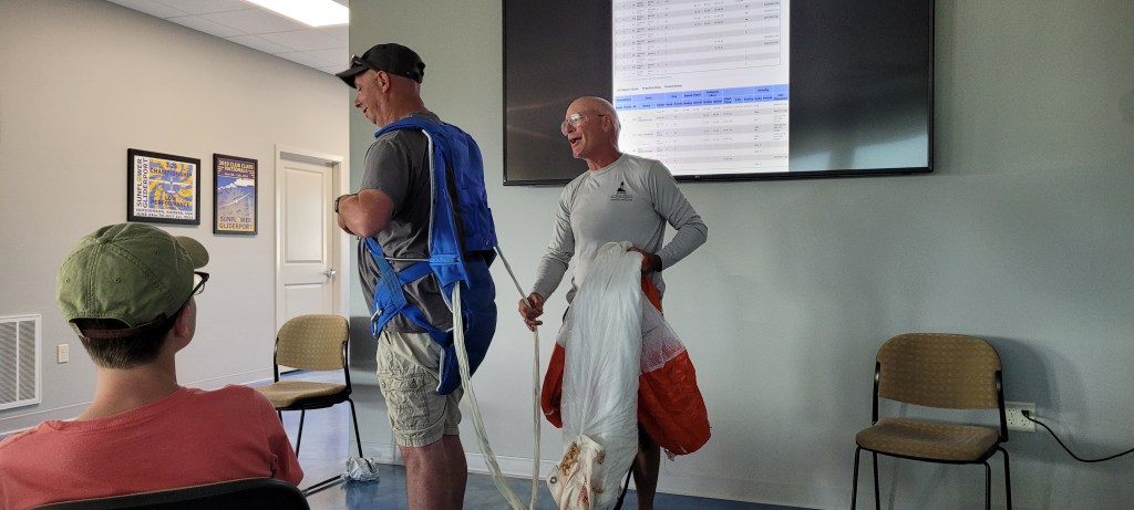
One of the most important volunteers at this contest is of course the Contest Director, Mitch Hudson. After putting the dinner, he hosted the safety talk where he pointed out that soaring is an excellent hobby; expensive, fun, and pointless. So don’t do anything stupid; safety talk over! The ops discussion, pointed out that we have a 7000ft runway, so use it if you get in trouble, and don’t do any stupid, low energy maneuvers. And then we had a demonstration of how to use a parachute correctly, with Mitch pulling the chord on his chute. One thing I learned was to dispose of the D-ring after pulling it. I never knew that holding on to it could prevent the parachute from opening safely!
Now I’m settled in the camper van, twisting the ring on my finger, listening to rain chattering on the top of the roof, anxious in anticipation as to whether we are going to get super soaked and have marginal conditions tomorrow, or if it will kick off better. The forecasts are promising, though only time will tell. Tomorrow we get to race and that is always fun!
__________________
We thank the Harris Hill club for supporting us at this contest by letting us use their Duo Discus. This glider is an absolute marvel of performance and it has made it possible for us to compete at the highest level among the best pilots in the United States. We really appreciate all the work it takes for clubs to make these opportunities happen.
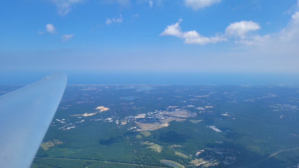
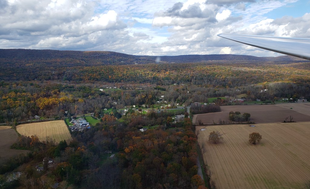
Once in a blue moon, and when the tides, stars, and a continental low-pressure system all align just right, something magical happens on the Kittatinny Ridge. The magic begins with a breath of warm, moist air seeping in from the ocean at just the right angle and strength. Upon colliding with the ridge, this laminar air deflects upward into a narrow band of lift, no more than a wingspan and a half wide, creating lift so smooth that it is almost wave-like. These days are so rarely soarable because the weather patterns that create these conditions usually coincide with heavy rains that cloud over the whole ridge.
The weather setup for this late October day was no exception, with the preceding day sparking flood warnings throughout the neighboring states due to the torrential downpour. This resulted in the kind of cold, damp air that permeates your house and sinks right into your bones, making you shiver from the inside out. Nothing felt better than to crawl under the bed covers. It seemed improbable, maybe even impossible that tomorrow could even be a flying day as the rain pelted the roof and the gusts of wind howled against the windows.
The forecasts for the following day had shifted wildly, with the wind direction fluctuating from 090 to 180, at all sorts of varying velocities, and predictions for clouds and rain at different times over the day. I could hardly believe it when I saw the model soundings suggested that the skies would part in the afternoon elevating the clouds well above ridge top and the wind swing around to a southeasterly direction. Nonetheless, I cautiously sounded the klaxon for my fellow club members, hedging my bets that I’d take another look at the forecast in the morning before committing to the day.
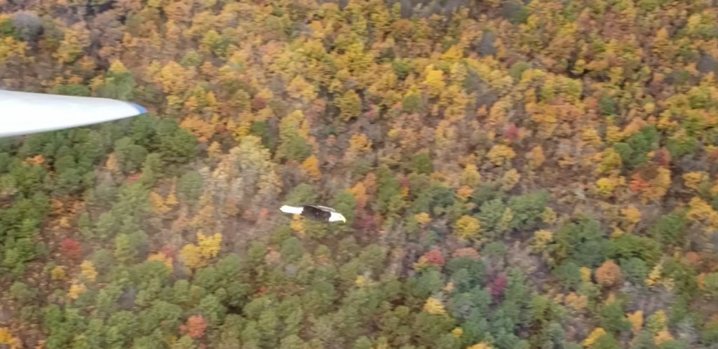
The following morning, I couldn’t contain my excitement when the forecast had improved. It was so electrifying because this was going to be the perfect day to bring Jen, now my fiancée, to experience her first time soaring the ridge. This kind of smooth day is ideal, plus there’s no need to do all that nasty circling that serves to continuously churn the contents of one’s stomach as we thermal. Doubly so, the fall foliage had just peaked in our area, so the whole ridge was going to be a beautiful palette of yellows, oranges, and reds. Triply so, this was around the peak of the bald eagle migration, and we know how much Jen loves bald eagles!
I promised her that this was the day. We would go up on the ridge, fly maybe 60 miles or so, do some bird watching, and enjoy the fall foliage. I’ve been waiting for these conditions for over a year, and it was just so perfect. Jen said I looked and sounded like a five-year-old on Christmas! All the while the outside sky looked dreary and grey, not the kind of conditions that inspire racing out to the airport.
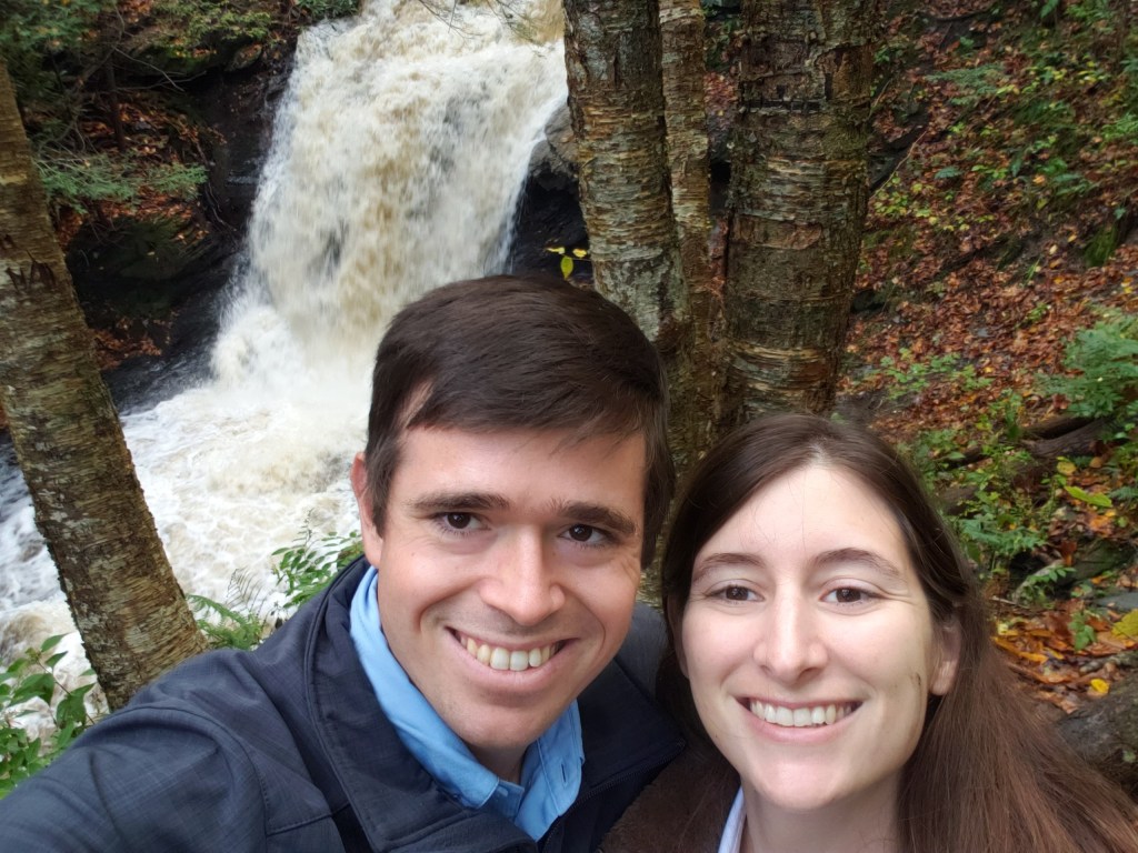
We had a nice and slow morning as the soaring conditions would only improve in the early part of the afternoon. As we drove through Pennsylvania, we admired the beautiful countryside, rolling fields, and rustic barns. We stopped by the scenic waterfall along Slateford Creek near Portland, PA. Thanks to the recent heavy rains, the creek overflowed with torrential, muddy water gushing over the ledge. Jen said it was quite a different sight compared to last time, when the small steady stream was so peaceful and clear.
We trekked back to our car and proceeded to the airport, arriving just a little after noon to be greeted by the convocation of glider pilots huddled together protecting themselves from the damp easterly wind coming down along the runway. Guido, our energetic and excitable Italian, eagerly awaited my arrival. He was going to take the first flight of the day with me, hoping for a chance to experience some ridge conditions. He had the club Grob Twin Astir, affectionately known as Greta, preflighted and ready to fly.
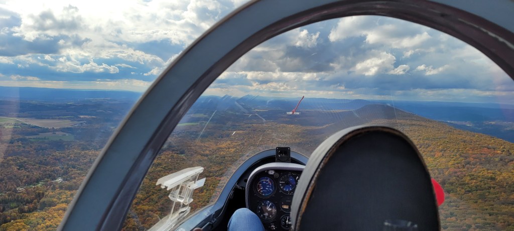
Closer to 1pm, the sun started searing holes in the grey blanket of clouds above. We basked in the warmth and watched expectantly as the outline of the ridge appeared in the distance. In mere minutes, the clouds lifted above ridge top and we signaled Tommy the tow pilot that it was time to give it a go. Guido and I launched, experiencing the strong wind blowing us toward the ridge. At 1500ft above the airport, we popped off tow, right over the mountain. We nestled right into the ridge lift, which pushed the glider higher and higher, such that we were maintaining 60 knots at 2100ft MSL. The clouds were at all sorts of different levels, with some wisps even forming below ridge top on the downwind side of the ridge. But on the upwind side, the clouds were rapidly rising, the sun was shining, and the day was looking beautiful. I called Philip back at the airport to let the folks know that the surf was up and it was time to fly!
After a couple beats back and forth the local ridge in the high band of the local ridge, I finally couldn’t take it anymore. By the Upper Reservoir, I asked if I could take the controls. Guido let out a long-excited gasp as I made a very steep turn, peeled over and dropped onto the trees cruising at 100 mph. The lift was rock solid, so I gave it back to him with instructions to slow down and float up a bit higher. I was going to give him a taste of ridge cross country soaring was like, so we kept going southwest bound.
The big challenge was locating the narrow ridge band. The sweet spot in the lift band was very elusive with such a steep mountain face that is constantly changing shape, bending around and rising and falling in elevation. I find that going a fair distance in a straight line is both fun for the student, but also instructive in really learning how to find that best part of the lift. So Guido and I cruised past the Bangor Offset, and had to bear with my coaxing and admonitions geared at making minuscule corrections in pitch, roll, and yaw, constantly adjusting for the slight gusts on one side or the other of the glider that hinted at the best lift. Guido did a wonderful job and we were at Lehigh Gap in what felt like a heartbeat. Looking over our wing, I pointed out that Slatington Airport is a Silver Distance away from Blairstown. Guido was shocked and amazed at how fast we made so many miles!
As we turned, I glanced at my watch and saw it was 1:35pm. I texted Jen that we’re 30 miles out and we will land at 2pm. By all accounts it should work exactly as so, but what an amazing thought that one could be in a glider and expect to time an arrival like so. Sure enough, Guido and I flew on back, made our landing pattern for Runway 7, landing long on the clear runway in perfect position to launch for the next flight. Jen came on out and sure enough, it was exactly 2pm. I grinned as I announced that Aero Club Albatross Airlines was ready for the next customer.
We launched straight to the ridge and sure enough it was still working perfectly. We hung a left on the Appalachian super-highway and had no trouble floating along at 70 knots 400-500ft above the ridge. The air was smooth and the glider felt like it was on rails. Jen marveled at the glorious array of colors all around us, as far as the eye can see. The sun shined through patches of clouds in the distance in a radiant and delightful glow. Even the trees beneath looked like they were celebrating, gently dancing to and fro to a steady beat as the breeze kneaded through the forest below, the amber colored leaves shimmered in the sunlight.
Jen remarked that the ridge looked like God’s carpet, with the gentle rolling colors mimicking a plush carpet beneath us.
The radio was turned down, along with the usually noisy variometer. No need to listen to the crazed manic-depressive beeps and boops that are symphonious only to the ears of the equally crazed soaring pilot. The glider quietly hummed in the breeze.
Silence.
We kept floating along peacefully, until Jen giddily exclaimed that she saw bald eagles ahead! Sure enough, there was a group of three of them thermalling together. Seeing that Jen was so excited to go play with them, I made a hard reversal and joined these glorious birds. I circled with them and we made a couple passes less than a wingspan below. Jen couldn’t contain her wonder and joy, grinning from ear to ear. I saw that they were heading north bound, and figuring I’d give her a break from all the unexpected circling and maneuvering, I levelled off and kept heading along the ridge. When she expressed disappointment that she wanted to soar with our companions some more, I said, “Don’t worry, we’ll see them again soon on our return trip!”
After turning back at the Pennsylvania Turnpike Tunnel, sure enough we spotted the bald eagles again! This time they were a little below us, so we made a couple of closer passes. Once we had one just off our wingtip. It felt like my arm was extended, my hand reaching out and inviting our feathered friend to join us in a dance.
Sometime around this time, Jen remarked that I delivered on everything I promised that day. Beautiful foliage, ridge soaring, and even bald eagles too!
I replied that would be true, only once I safely brought her back to the airport. So, we headed back home along the ridge. As we returned to the local ridge, Jen reported that she still felt wonderful and fresh, so I figured I’d end this flight with some excitement. Upon crossing the Delaware Water Gap, I pushed the nose over and dropped the glider down on the trees. The airspeed just over 100 mph, the glider was now in the rough and tumble of the gusty air right above the ridge. You had to take care not to focus on the crisp individual branches whizzing by as your head would snap around to keep them in view. The glider was jostled a couple times by thermals rolling over the ridge. Jen asked if this was what a violent ridge felt like. Nope, trust me this is light! A violent ridge feels like you’re inside a laundry machine, set on high spin!
Now abeam of the airport, I pulled up to gain a little extra height for our return trip. Jen was really surprised that we had been flying over an hour and fifteen minutes, her longest flight to date. After we landed, she remarked that it felt like the flight went by in a flash!
With the ridge still working, I felt up for one more flight. Operations were winding down and Tommy had put away the towplane. With no one around the flight line, I was wondering who I could take for a ride. At this time, I saw Tommy’s truck heading toward us and he felt like a great victim. When I offered to fly with him, he eagerly accepted, saying it was his first time flying the ridge in a glider, and his first flight in the Grob. We quickly strapped him in and Aaron gave us a quick tow in the Pawnee to the ridge.
Sure enough, the ridge was still working! Nonetheless, the conditions were softening up, now becoming difficult to float above 1900ft. As we crossed the Water Gap, I saw the trees more in the slow dance phase of the afternoon, and we settled down to 1800ft. The ridge was still consistent and smooth, though we turned at the hang glider launch as it was prudent to stay closer to home.
I gave the controls to Tommy, who was delighted to feel what riding the ridge was like. He was smooth and solid on the controls and had no trouble staying in the lift. We flew up to Catfish Tower, and then looped back to the local ridge. The wind kept weakening and weakening, with the leaves hardly moving at all. I took the controls again and we kept floating along the weak ridge, with every beat getting a little lower. We were finally level at ridge top, with Tommy exclaiming amazement at how little wind it took to sustain the glider in the air. After a little over an hour, with the wind giving its dying breath, we headed back to the airport, landing just shy of 5pm.
We were the last ones down. After Jonathan and Bobby stopped by to announce that they were heading on a retrieve for Chip, who had fallen off the ridge near the Bangor Offset, the airport became completely deserted. We cleaned the glider and tucked it away for the evening, watching the mostly overcast sky with crepuscular rays in the distance shining through holes in the clouds like a shower of gold. Right as we had everything tidied up, Ron and Betty Schwartz stopped by to invite Jen and me for dinner. After we all enjoyed the beautiful sunset, we had a delightful dinner together in the town. Unlike Ron, Betty had plenty of answers when I asked her, “What lessons have you learned after 58 years of marriage?” We spent a whole evening trading stories, watching Ron shrug helplessly as Betty gleefully shared stories when they were dating back in Iowa (including one scandalous story about how Ron dared to wear jeans – Levi’s, no less! – when they were in college).
The only other person I know that radiates joy and happiness like Ron is Jen. I don’t know how people earn that ineffable quality, and there is nothing more delightful than surrounding yourself with such wonderful people. I felt the tingling warmth in my heart the whole way home, warming both my bones and soul.
And with the snap of a finger, it’s all over. Eleven days of some of the most difficult flying with the best pilots in the world. The weather was weak, but we pulled every single ounce of soarable weather out of the Montlucon sky. Yesterday we crowned the champions of each class. Sebastian Kawa unsurprisingly won 15M with another superhuman performance. The Germans had an especially good go, with two teams winning the contest, with Uwe and Stephan coming in first and third in our class. Uwe and Stephan flew an excellent race, consistently flying very well. The most pleasant surprise was Thies (IV) from the Netherlands earning Silver in our class. He is a class act, an excellent pilot, and we are thrilled with his excellent run at this event.
The Club Class world champions!
I felt that the US Team flew well, even if the scores didn’t always reflect it. Flying here was like walking a very thin tightrope every single day and even the slightest mistake would lead to disaster. A couple hundred feet in a typical contest is peanuts, a handful of seconds, maybe a minute or two of performance. Here it meant all the difference between connecting with a bubble, or landing out, or making it home on a zero glide, getting penalty points, or coming up short. I don’t think any of us had flown an event which demanded such persistent execution with such thin margins all the time.
JP and I debriefed and we reflected on things we did and could do better. Overall, we felt that after three Junior worlds, we understood the FAI and gaggle game reasonably well. For once, the errors we made were less because of being from a different continent, but rather details in tactical execution. We fundamentally understood that these contests are about flying with and managing the group and we successfully flew with this mindset throughout most of the event. Further, the level of flying was actually not all that different. The top junior pilots were the ones doing well here too. We flew with them before and we felt no different facing the gaggles and the strategy and tactics than what we have done before.
We also discussed several points that dragged us down. These included:
When starting late on an AAT, you MUST come back on time (or early).
Flying AATs in the worlds is different than back home as the group still matters a lot and is actually harder to keep track of. Further, the pilots are more willing to go deeper if the conditions are improving far away from home. However, we underappreciated this gamble as the conditions decayed rapidly at the back end of the day. So if starting late on an AAT, you must be willing to come back early if your last leg is reasonably quick to minimize the risk of falling off the back of the day.
Never give up.
No matter how bad it looks ahead, you can probably go another 60 miles farther, or even complete the task. On one blue, windy day, it was getting late and I got demoralized and didn’t work as hard. The gaggle flew another 100km! The next day, I shifted my mindset and drove hard despite the conditions and won the day. It’s as much a mental game as one of talent and execution.
In weak conditions, take an early start with the first viable group, even if you’re not in perfect starting position.
In the worlds, the start game decides a lot over the day. We did better here than in past events, though we tended to start too late in weak conditions. The challenge is that you are not always in a position to go; the day cycles in and out and you have to take your chance when you get it. Sometimes we were ready to go earlier, but we talked ourselves out of going and then lost our opportunity for another 15-20 minutes. The reality is that in weak conditions that gaggle is likely to hit a brick wall at the end of the day anyway. With so many landouts and such thin point spreads, getting “rolled” by the gaggle if you get stuck on the first leg is not costly. However, “falling off the back” of the gaggle at the end of the day is disastrous. Starting earlier is a better bet in short tasks in weak conditions.
Get in a controlling position on the gaggle in weak days.
Several hundred feet makes all the difference. The pilots that did the best were the ones that managed to climb several hundred feet higher in the weak thermals and stay connected at the top of the thermal. Their bubble would die a little later and the pilots underneath would be forced out. They would be able to stay higher, a minute or two behind the poor folks underneath doing all the dirty work.
On weak days, that’s where you want to be to do well.
Hardware issues.
This one was much more on JP’s side than mine at this event. I was lucky to fly an excellent ship restored by Ross Drake, so for once everything worked! JP though struggled with his CG, Flarm, and variometer, which caused all sorts of grief. He had a hard time getting the glider to climb much slower than 90 km/h, whereas I was able to slow down WA to 80 km/h. JP wasn’t the only one on the US Team with issues with their rented glider at this contest. It’s just a reality that we’re somewhat handicapped at these events through the necessity of flying different, rented gliders. Uwe, the Club champion owned his LS3 since 1987. We simply don’t get the luxury of tuning everything to perfection and getting super comfortable with our equipment. That said, I felt very good in WA.
__________________
I hope that we acquitted ourselves reasonably for the US team. I certainly had a wonderful experience in Montlucon and can’t thank everyone enough for giving me this amazing opportunity to fly with the best pilots in the world. First, I’d like to appreciate the organizers at this contest, who pulled off the most unlikely event with the most difficult challenges facing them in many years. Thierry and Beatrice were amazing and did a fantastic job simply making this event happen at all, and then did a tremendous amount with the little weather we had.
Colin Meade, our team captain did an outstanding job. Despite the logistical challenges, he managed to get everyone and everything together. For the past two years it has been really touch and go, with highs and lows in planning this and negotiating the COVID circumstances. Colin did a great job at the event keeping the pilots focused on flying. I also appreciated his kind words of encouragement on the radio, which worked outstandingly well at this event and helped provide important information for us when we asked for it. Thank you Colin and Cindy for all your hard word; you were the keystone in having the US Team represented at this contest.
Thank you Donat-Pierre Luigi for being an excellent crew and friend. After we synced up and kicked into gear, you did an excellent job managing the glider and its equipment and keeping me focused on flying. Thank you for your interpreting services, both for me and the team as a whole. We had a lot of fun and I’m looking forward to seeing your name in the French contest circuit in the near future.
Thank you to the team crews. Jacob, Raul, Holden, Cindy, Paul, Rob, John, and Jason, you all were an amazing bunch! At one time or another, you helped me assemble the glider, borrow equipment, retrieve me in a field, or listen to my tales of joy and woe in the sky. Thank you for all your help!
Thank you Alain Daumas for lending me your family’s car and helping with all the logistics of coming into and out of France!
Thank you Jen, for supporting me going to the Worlds. I really appreciated you coming and joining us in France and I am so happy that we could share this experience together. These memories will live on for our whole lives!
Thank you to my club, Aero Club Albatross back home, that have supported my flying for my whole soaring career. It’s the folks back home that coached and mentored me, retrieved my sorry butt out of many fields and otherwise kept me honest. It was an honor representing ACA at a World Gliding Championship.
And ultimately, thank you for all the folks back home that support the US Team to make this possible for us. Your sponsorship and contributions allow people like me that cannot afford spending $10,000 for a glider contest attend these events, race hard, learn, and help develop the team into the future.
______________
And with that folks, the FAI flag has been furled and the contest is over. Thank you for following along and I bid you adieu.
Greetings from Montlucon! Today was the last competition day and we were expecting ground hog day once again; weak, blue, tricky conditions. Early on it took a long time to cook and the launch once again was delayed and delayed. I took the opportunity to walk up and down the grid to talk to a couple folks I hadn’t had a chance to during the contest. Among the interesting things was seeing the Finnish tow ropes, which looked like they can haul a beached cargo ship out of troubled waters. Those tow ropes never break!
When we launched, everyone struggled to stay aloft. The gaggle milled around in the blue just under release altitude. One pilot in 15M even landed out just outside of the start line! We struggled and struggled, trying to stay alive both in soaring terms and in the busy gaggles.
We expected that with the tricky conditions that our class would go in one big group. However, this was not the case. The class instead trickled out on course and we missed our first good opportunity to go. Returning to starting position took a while, though we linked up with Thies (IV) and Robin (RSM) from the Dutch team. We really like the Dutchies and were really happy that Thies was in contention for Silver. We were happy to aid them along on this final day.
We started as a gaggle and chased out on course. The thermals were still painfully low and weak, though the ground slowly dropped off heading north. I pushed out ahead as I was higher than the group, finding a thermal down at 600 meters at the edge of a field and a forest. No use hanging back in the gaggle today, if I mark thermals ahead then I am doing better work for the group.
JP and the Dutchies caught up and we were flying together. Thies greets us on our frequency and we start team flying as a group of four. The day got a bit better, with some Cu and 1.5-2 m/s thermals. We were driving hard, chasing down Robin who was a bit higher in his LS4.
On the second leg I led out a bit too far and diverged from a cloud that the group ultimately took off to my side. Rather than sidestep and latch into the group, I drove forward, again looking to mark a thermal. I had to take a large deviation to do so, but found 2 m/s. JP joined me, though the Dutchies took the straight line and got a little ahead.
We linked back up at the second turnpoint, though a little bit lower, perhaps 150 meters or so. We kept with them and when one bubble did not work for me, I kept going ahead. I found a weak bubble at 600 meters and the Dutchies and JP joined above. This gave the Dutch pilots almost enough for final glide, though the thermal weakened for JP and myself such that we deviated toward a baking field with a tractor, hoping to get a final climb.
It didn’t work. Other than a weak thermal down at 600ft that hung on at zero for a while, the day just simply gave out on us a little too early. I landed first in a cut wheat field and JP joined shortly thereafter. We were a little over 10km short.
We were very happy to hear that Thies and Robin made it back and that Thies managed to keep his second place position for the contest and we felt that our little group did just fine for the day. We started a bit too late which caused troubles at the end, but ce la vie. JP and I were happy that for once we managed to stay together the whole day.
The retrieves went well. We met our first farmer during the whole contest and this fellow actually spoke excellent English. Apparently he did business in Delaware in a past life and traveled quite a bit to the states. We thoroughly cleaned the gliders and brought them back home.
Among several notable traditions at world events are the closing party. After we arrived, we got a quick dinner at a buffet and joined the raucous group at the airport. Here the US Team shared the champagne I won several days ago and reminisced on recent contest stories and some John Good stories from back in the day. Later they turned the runway lights on and apparently the party moved up and down the runway.
Another tradition is trading team shirts. This year I arranged several, scoring Swiss, Italian, and Ukrainian shirts. The Ukrainians were especially fun, giving me a Ukrainian flag while they were at it. I really enjoyed the team and international spirit at this event.
Since I am in a bit of a rush this morning, I will leave concluding remarks for a later post tonight after I spend a bit of time reflecting on the journey while driving my trailer to Switzerland. Stay tuned!
_____________
Thanks to my friends at Aero Club Albatross, who have given me all the resources, mentoring, and opportunities to grow as a recently aged-out junior pilot. Thanks to the many people who support me and the US Team to make flying at a WGC possible.